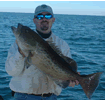
A unique website dedicated to fishing information from Florida's Northern Big Bend. This includes the area from the Econfina River west to the Apalachicola River
I've updated the area charts page and underlying pages:
--On the area charts page I have reorganized the links to make them easier to find and read.
--The reefs waypoint list has been reorganized and redesigned. I have also added SEVERAL new waypoints including..
New Yamaha Reef Coordinates
New Bryson Reef Coordinates
St. George Island Bridge Reef Coordinates
Rose City Reef Coordinates
Several new "public" numbers
A few new rocks from the St. Marks Flats including the Carolina Death Rock
New navaids such as Carabelle River Entrance, Sikes Cut, Dog Island Sea Buoy, etc.
Also Correct Depths for most reefs
Alphabetized listing
--Updated the Mapsource File to the latest version (6.5). There are now 2 files for download
1. MPS File Format, which is the older backward compatible format
2. GDB Format, which is the newest format for the newest versions of Mapsource.