A unique website dedicated to fishing information from Florida's Northern Big Bend. This includes the area from the Econfina River west to the Apalachicola River
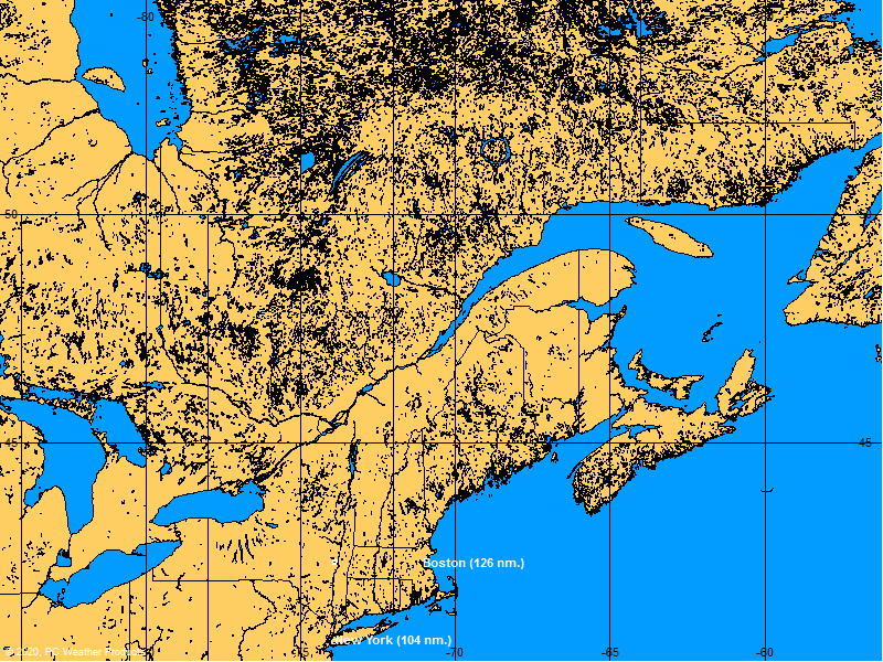
Here's hoping it stays well east of Anky! No fun when storms threaten our homes away from home down there! Hopefully it will bring some much needed rain to SE without the other dangers!
It may be that my sole purpose in life is simply to serve as a warning to others.
No, I'm all for the rain. The pond at my farm is down a good 2 foot again. However, I was going to leave my boat at the Shell Island fish camp this week rather than dragging it all the way back from the Cape, but it looks like it is going all the way back to Valdosta now.
CrispyFishin wrote:Don't the forecasts make Fay look like she is going to hit the big bend as a hurricane?
Not so far. Yesterday's 5pm briefing said it may or may not upgrade to category 1 over the atlantic in the next couple days. If it does, it will still have to travel 200+ miles over land to hit us here, which will weaken it a bit, but if that happens we will get some really nasty weather. Right now there is a high pressure front building north of Jax and moving south that is what is supposed to push it back west. If that happens, it should also weaken it as it pushes it back. Some of the 'what *might* happen' computer models have it pushing back across the state moving southwest, then possibly building strength back in the Gulf and making landfall in the Fort Walton Beach area. That's probably the worst-case scenario for us at this point.
The band that passed over the southern big bend last night spawned multiple water spouts in the SGI area around 8pmEDT. The mid-day report from Okechobee county EMS yesterday said they had 22" of rain on the guage at about 3pm eastern, and frequent gusts of 70-80mph (which is barely cat 1 hurricane strength) with sustained winds of 45-55mph. Right now the thing is moving relatively slow and dumping a ton of rain. Would be nice if GA could have some of that rain. Just have to wait and see what happens...
Mookbait! At least 401 times better than live bait!
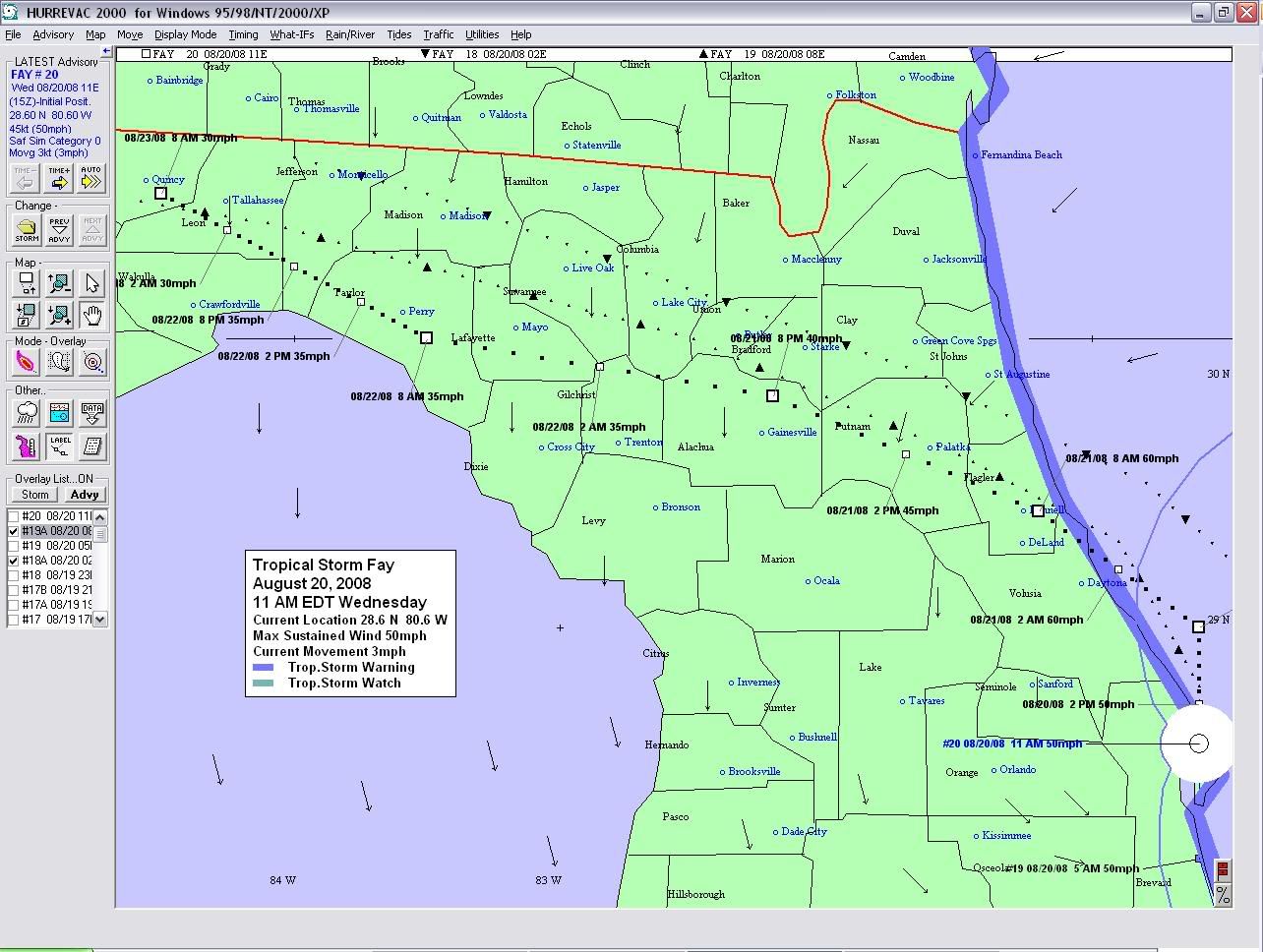
13Z Update 20 as of 11am EDT today: This is a 'primary' projected eye path. The first picture Barry posted in this thread is what's called an 'error swath' path, meaning the eye could travel any path inside that white area. I overlayed the 2am and 8am primary path updates to show the recent trend. If the southward trend continues, it will end up in the Gulf where it could gain strength. If not, it's currently predicted to hit the Tallahassee area some time Friday with winds around 30mph and probably die out some time during the weekend.
The dotted lines on the pic are:
line made of downward facing arrows is the 2AM 8/20 update
line made of upward facing arrows is 8AM 8/20 update
line made of squares and data tags are the current advisory update (11AM EDT 8/20)
Mookbait! At least 401 times better than live bait!
lol - actually I work on software and databases etc, including Emergency Ops software, so babysitting all of this to ensure it's working is actually my job right now. I'm on my lunch break and thought I'd let y'all in on a screenshot from the gubment software.
Mookbait! At least 401 times better than live bait!


 _______________