The below chart shows my approximate track and location.

I trimmed the motor up, I had a several moments of panic, and then the boat floated, and the wind began pushing us east. I know there is a sandbar and shallow area south of there, and my Garmin chart showed 3' depths, while Navionics showed 2'. Plainly it was much less. I'm assuming that the wind was pushing the water off of that normally shallow area, but by nearly 1' in total depth? We drifted for at least 10 minutes before we started seeing 2' on the depthfinder, and began some fishing.
Is my theory correct? Are my charts wrong? Am I a bad captain?
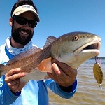
Anyway, we were able to fish for about an hour, landed two trout, one flounder, and a ladyfish, and lost a really nice trout along the way. Had a finger mullet on a cork drifting, and something grabbed it without catching my hook.

On the way back to Shell Point, we took the channel west of the bar to the deep water, and pounded through the waves until we got back. There was a boat that appeared to be sitting on the sandbar waiting for high tide, but I couldn't tell from the distance. I think I underestimated the impact of wind on water depths...