
this is my first time posting to any board, so forgive me of my goofups as i learn my way around.
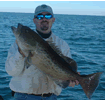
there have been a few post over the last month about scalloping. has anyone been looking lately? i normally go out of keaton but am looking for places to scallop around st marks, panacea, and carabelle.
any help would be appreciated.
scallops
Moderators: bman, Tom Keels, Chalk

Like Tom said, the visability is just to poor right now to tell  And if someone mentions sewage or turds floatin, just ignore it
  We have been shootin the bull pretty thick about the Scallops
“Before you criticize someone, you should walk a mile in their shoes. That way when you criticize them, you are a mile away from them and you have their shoes.”

hopefully i can fish some of the time and also maybe scallop the weekend of the 4th. we have rented a house at shellpoint for the 3rd through the 6th. if anyone wants to share their expertise of the area or possibly even join me for an afternoon on the flats, i am open to suggestions.
also, i am curious as to where the rock garden is. i have seen it mentioned on 2 different sites, but cannot find it on my charts
thanks
also, i am curious as to where the rock garden is. i have seen it mentioned on 2 different sites, but cannot find it on my charts
thanks

I don't run over that way much, but when I do, I run out of Shell Point about 3 to 4 miles and then cut across You don't have to worry about rocks or Oyster bars untill you get close to the St. Marks river  but there are some mighty shallow sand bars inbetween and some are out 2 miles or better Try and make the run the first time on a high "there bouts" tide and watch the depth finder. If you draw less than 2 foot of draft you will have no worries on a high tide "I draw less than 6 inches when runing and have hit bottom on a low tide" Tom can tell ya more about once ya get to the river headed East
“Before you criticize someone, you should walk a mile in their shoes. That way when you criticize them, you are a mile away from them and you have their shoes.”

There is a sand bar a little east of the Shell Point channel you have to watch out for. After that, you can run all the way to the river without much problem. Wevans is correct. There are several spoil bars on the west side of the river channel. There are only a couple of places you can get through them. One is almost due west of the light house. When you get within a quarter mile of the river, in close, slow down. If you try to make the crossing further out, there is a very big sand bar you will run aground on out west of the bird rack. If you run aground on that one you will have to wait for a high tide (how do I know that).
If you'll e-mail me a couple of days before you come, maybe I can fit a few hours of fishing into my busy schedule, and show you where to run.
Good luck!
If you'll e-mail me a couple of days before you come, maybe I can fit a few hours of fishing into my busy schedule, and show you where to run.
Good luck!
What was I supposed to do today?
-
Fish Masterson
- Site Sponsor
- Posts: 425
- Joined: March 1st, 2003, 11:07 pm
- Location: Wacissa