A couple of map reading questions

Moderators: bman, Tom Keels, Chalk
-
Hit-n-Miss
- Posts: 3536
- Joined: May 20th, 2004, 12:15 pm
- Location: Boston Ga.
A couple of map reading questions
I have a couple of questions I hope someone can help me with. On the Florida Sportsman St. Marks map, where it says pile what is that? Also west of the big sandbar a dotted line slants up to the west is that the stake line? Thanks
-
Dubble Trubble

- Site Sponsor
- Posts: 2310
- Joined: October 30th, 2005, 7:46 pm
- Location: Thomasville
Re: A couple of map reading questions
A pile is just that, usually a pile of rocks dumped or concrete scraps from a bridge torn down...etc.
The dotted line you are referring to is what is called the "St. Marks range". It has to do with the lighthouse, but not sure exactly what it is. I am sure someone on here knows that answer.
Dubble
The dotted line you are referring to is what is called the "St. Marks range". It has to do with the lighthouse, but not sure exactly what it is. I am sure someone on here knows that answer.
Dubble
The more I know about something, the more I know that I did not know as much as I thought I knew that I knew.
-
fishinfool
- Site Sponsor
- Posts: 3131
- Joined: June 17th, 2009, 8:58 pm
Re: A couple of map reading questions
Sorry Dub, pile is a pole or post. Pilings are a group of piles to make up a structure. Many of the piles I have seen marked on our local maps are no longer there or have rotted off at ground level. You will also see "platform ruins" marked, and I have yet to see any evidence of them.
-
Hit-n-Miss
- Posts: 3536
- Joined: May 20th, 2004, 12:15 pm
- Location: Boston Ga.
Re: A couple of map reading questions
Is that what people refer to as the stakeline? So pile is not marking an oyster bar?Dubble Trubble wrote:A pile is just that, usually a pile of rocks dumped or concrete scraps from a bridge torn down...etc.
The dotted line you are referring to is what is called the "St. Marks range". It has to do with the lighthouse, but not sure exactly what it is. I am sure someone on here knows that answer.
Dubble
Re: A couple of map reading questions
I was looking at the chart this weekend as well and wondered if there were any remains in the spots that are marker Platform (ruins). Does anybody know what was there years ago? I'm sure there weren't any oil platforms in that area.fishinfool wrote: You will also see "platform ruins" marked, and I have yet to see any evidence of them.
-
Dubble Trubble
- Site Sponsor
- Posts: 2310
- Joined: October 30th, 2005, 7:46 pm
- Location: Thomasville
Re: A couple of map reading questions
I stand corrected then. I thought a piling was a post, and pile just referred to piles of debri. Got to brush up on my nautical terms... 
Dubble
Dubble
The more I know about something, the more I know that I did not know as much as I thought I knew that I knew.
Re: A couple of map reading questions
As the previous posters have written, "pile" on the chart refers to a piling, which was there when the chart was compiled or drawn. A number of the "pile" (s) shown on the charts are no longer there. The series of pilings offshore of St. Marks were set by the feds long ago to mark the extent of the St. Marks National Wildlife Refuge. However, I don't remember the feds ever asking for or receiving a lease from the State for this area, so the water boundary probably has no real federal regulatory effect. Those "rocky" or ** marks also indicate rocky areas, but of course there are many more, as lost lower units have shown!Hit-n-Miss wrote:I have a couple of questions I hope someone can help me with. On the Florida Sportsman St. Marks map, where it says pile what is that? Also west of the big sandbar a dotted line slants up to the west is that the stake line? Thanks
Luck,
EJ
Re: A couple of map reading questions
Is that what people refer to as the stakeline? So pile is not marking an oyster bar?[/quote]
Yes, that is the stakeline. There are several Post/pilings/wooden poles marking the refuge boundaries. You'll see that the small white bouys are in between and in line with the them and I think they actually say have writing on them that they are boundary markers.
Yes, that is the stakeline. There are several Post/pilings/wooden poles marking the refuge boundaries. You'll see that the small white bouys are in between and in line with the them and I think they actually say have writing on them that they are boundary markers.
Re: A couple of map reading questions
Those spots marked "Platform ruins" were a more or less square group of pilings with a wooden platform on top. They were more commonly called bird roosts. The cormorants/pelicans/etc roosted on these platforms and the poop (Guano) was collected regularly and used/mixed/sold for fertilizer. There were many of these bird roosts scattered from St Marks down to at least Pepperfish Keys that I remember. Not sure how much farther West or South they might have been. They were prime spots for spearing or catching flounder, grouper, and some large cobia. Those that existed off Dekle Beach. Keaton Beach and Big Grassy Island were especially productive. Over the years they fell in desrepair due to storms and natural aging. They weren't repaired/maintained after the collection of the guano ended sometime in the early 50s. What remains today are the stumps of the pilings and the concrete casing they were sunk into. Light colored sandy spots still show where some of them were.
Re: A couple of map reading questions
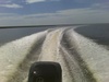
There are only two original "pilings" or steaks remaining on the stake line. They have come along and replaced the missing pilings with short white floats that mark the boundary of the St. Marks Wild Life Refuge. When you are on the steak line, you will be able to see them (most of them). They form what looks like a straight line but actually they form a mild arc. Lot of folks use the steak line as a sort of "safe-line" or the highway from east to west. Would post a picture of one of the floats if I had one.
Time is the most precious commodity we have in life, stay focused.
Re: A couple of map reading questions
Re: Range Line - had to look it up but appears to indicate position for channel entry using the described lights (pre-radar/GPS). Checked my chart, sure enough the range line is dead center of the channel markers at the entrance from seaward...
"Leading lights or range lights, consist of a pair of lights located such that they indicate a specific line of position - called "range line" - when they are observed "in line". Seen from seaward, the higher rear light is placed behind the lower front light.
When the navigator sees the lights vertically in line, he is proceeding on the range line. If the front light appears left of the rear light, the observer is to the right of the range line. If the front appears to the right of the rear, the observer is left of the range line.
Leading lights are often used to mark the center of navigable channels. In this case a vessel returning from seaward will keep the front light slightly to the left of the rear light while navigating on the right side of the channel.
Leading lights are sometimes equipped with intensity lights for daylight use. They are effective for long channels in hazy conditions when dayboards might not be visible.
Range lights are usually red, green or white. They display phase characteristics differentiating them from surrounding lights."
2008 Key West 196 Bay Reef
2008 Yamaha 150
2008 Yamaha 150
-
Jumptrout51
- Site Sponsor
- Posts: 11946
- Joined: December 12th, 2001, 7:00 pm
- Location: Tallahassee
Re: A couple of map reading questions
There were 11 original pilings marking the SM Refuge boundary from the River Entrance tripod to Aucilla River.
Three are still there.
The original #2,#4 and #11.
They were evenly spaced at 1 mile intervals.
Numbers 3,4,5 and 9 were hotspots for fishing in the '50's.
Most people would start their drift at the stake line and drift towards shore until the 3 foot depth then motor back out.
The boats in that era were mostly deep Vee,wooden and heavy.
Motors did not have tilt function.
Most fishing was done in 4 to 7 feet of water.
Tunnel hull mullet boats were the only boats that ventured inside 3 feet.
Their motors mounted in the bow.
Most of the trout fishing started Memorial Day weekend and stopped Labor Day weekend.
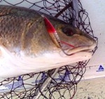
No one fished for redfish.
Redfishing started catching on around here in the mid to late '70s'.
It was introduced and encouraged by outdoor writer Harlan Franklin.
It took him a lot of years to get people to fish for and eat redfish.
There was no size limit on reds.
The eating part only got popular when the blackened redfish recipe was started in Loisianna.
Three are still there.
The original #2,#4 and #11.
They were evenly spaced at 1 mile intervals.
Numbers 3,4,5 and 9 were hotspots for fishing in the '50's.
Most people would start their drift at the stake line and drift towards shore until the 3 foot depth then motor back out.
The boats in that era were mostly deep Vee,wooden and heavy.
Motors did not have tilt function.
Most fishing was done in 4 to 7 feet of water.
Tunnel hull mullet boats were the only boats that ventured inside 3 feet.
Their motors mounted in the bow.
Most of the trout fishing started Memorial Day weekend and stopped Labor Day weekend.
No one fished for redfish.
Redfishing started catching on around here in the mid to late '70s'.
It was introduced and encouraged by outdoor writer Harlan Franklin.
It took him a lot of years to get people to fish for and eat redfish.
There was no size limit on reds.
The eating part only got popular when the blackened redfish recipe was started in Loisianna.
WHOSE FISH IS IT?
-
Dubble Trubble
- Site Sponsor
- Posts: 2310
- Joined: October 30th, 2005, 7:46 pm
- Location: Thomasville
Re: A couple of map reading questions
Yep, JT, I can remember when my dad would catch a redfish and call it "trash fish" and back in it went!
Dubble
Dubble
The more I know about something, the more I know that I did not know as much as I thought I knew that I knew.
-
Jumptrout51
- Site Sponsor
- Posts: 11946
- Joined: December 12th, 2001, 7:00 pm
- Location: Tallahassee
Re: A couple of map reading questions
You right! Redfish and amberjack were trash fish.
On the other hand broiled bluefish was on a lot of restaurant menus.
On the other hand broiled bluefish was on a lot of restaurant menus.
WHOSE FISH IS IT?