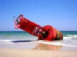
Wind!!!

Moderators: bman, Tom Keels, Chalk

They are wrong for this weekend, it's gonna blow a LOT harder than they are predicting right now  Low pressure and a possible tropical disturbance will ensure that

“Before you criticize someone, you should walk a mile in their shoes. That way when you criticize them, you are a mile away from them and you have their shoes.”

Tropical Wave 46 Remains Disorganized...Moving Toward Florida
Issued: 10:00 AM CDT Tuesday, October 4, 2005
At 10am CDT, the center of Hurricane Stan was inland over southern Mexico near 18.5N/95W, or about 100 miles southeast of Veracruz, MX. Movement is to the southwest at 8-10 mph. Maximum sustained winds are 75-80 mph. Now that the center is inland, Stan should weaken and dissipate very rapidly over the mountainous terrain of southern Mexico.
We continue to monitor tropical wave 46 near the Bahamas, spreading heavy showers and thunderstorms from just north of Puerto Rico, northward toward the Georgia and South Carolina Coast. Currently, there is still no signs of organization. This wave will be running head-on into a strong cold front across the eastern Gulf of Mexico and along the east U.S. Coast Wednesday night through Thursday. As a result, several strong low centers may form along the cold front. It's unclear whether any of the low centers will have enough tropical characteristics to be given a name, but they probably will produce some rough weather.
It still looks like one low could form in the eastern Gulf of Mexico on Thursday, with a second low forming along the coast of the Carolinas Thursday afternoon/evening. With plenty of cool, dry air flowing out across the Gulf of Mexico and off the east U.S. Coast, along with the presence of a sharp cold front boundary, neither of these two lows will be purely tropical in nature. But the low in the eastern Gulf or Mexico on Thursday/Friday could produce northerly winds of 35-45 mph over offshore waters from central Louisiana eastward to off the Florida Panhandle, as well as very strong thunderstorms across the eastern Gulf on Thursday and across the Florida Peninsula Thursday night and Friday. The low that forms along the coast of the Carolinas will cause strong winds and heavy rain from the Carolinas northward to coastal sections of southern New England on Friday.
Chris Hebert
“Before you criticize someone, you should walk a mile in their shoes. That way when you criticize them, you are a mile away from them and you have their shoes.”

-
Frank Bradfield
- Site Sponsor
- Posts: 535
- Joined: February 26th, 2002, 7:00 pm
- Location: Econfina

-
Frank Bradfield
- Site Sponsor
- Posts: 535
- Joined: February 26th, 2002, 7:00 pm
- Location: Econfina
Current conditions
Conditions at SGOF1 as of
(8:00 pm EDT on 10/04/2005)
Wind Direction (WDIR): NE ( 50 deg true )
Wind Speed (WSPD): 30 kts
Wind Gust (GST): 33 kts
Atmospheric Pressure (PRES): 29.94 in
Pressure Tendency (PTDY): +0.02 in ( Rising )
Air Temperature (ATMP): 81.3 °F
Water Temperature (WTMP): 82.9 °F
Dew Point (DEWP): 71.8 °F
Heat Index (HEAT): 85.8 °F
And it is supposed to get worse
“Before you criticize someone, you should walk a mile in their shoes. That way when you criticize them, you are a mile away from them and you have their shoes.”